

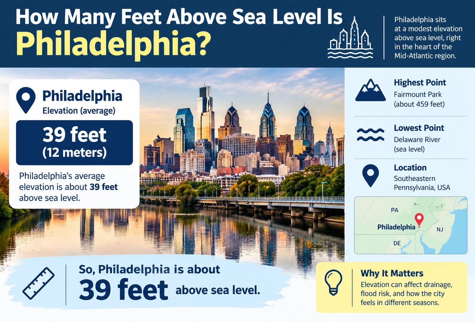
If you are wondering how many feet above sea level Philadelphia is, the city has an average elevation of about 39 feet above sea level.
However, Philadelphia does not have the same elevation everywhere. The city’s elevation varies significantly depending on the neighborhood and location. Current City of Philadelphia information reports elevations ranging from 10 feet below sea level to 445 feet above sea level.
For a quick general answer, Philadelphia is about 39 feet above sea level on average.
Quick Answer
Philadelphia’s average elevation is approximately 39 feet above sea level.
But the elevation varies across the city:
| Philadelphia Elevation | Height |
|---|---|
| Average elevation | About 39 ft above sea level |
| Lowest elevation | About 10 ft below sea level |
| Highest elevation | About 445 ft above sea level |
| Difference between lowest and highest | About 455 ft |
The U.S. Geological Survey also lists Philadelphia’s historical citywide elevation range as extending from sea level to about 441 feet, illustrating why a single elevation number cannot describe every location in the city.
What Is Philadelphia’s Average Elevation?
Philadelphia has an average elevation of approximately 39 feet above sea level.
This is a useful number when someone asks generally how high Philadelphia is above sea level. It does not mean every street, neighborhood, building, or landmark sits exactly 39 feet above sea level.
The city’s terrain changes as you move from the Delaware River and Schuylkill River areas toward higher ground.
According to the City of Philadelphia’s 2026 Hazard Mitigation Plan, Philadelphia’s average elevation is 39 feet, while the city’s highest point reaches 445 feet above sea level.
How High Is Philadelphia Above Sea Level in Feet?
The simplest answer is:
About 39 feet above sea level on average.
This is considerably lower than cities located in mountainous or high-elevation regions.
For comparison:
| City or Location | Approximate Elevation |
|---|---|
| Philadelphia average | 39 ft |
| Denver | More than 5,000 ft |
| Chicago | Around 579–673 ft depending on location/reference |
| Philadelphia high point | 445 ft |
| Philadelphia low point | 10 ft below sea level |
The comparison demonstrates that Philadelphia is generally a low-elevation city, although parts of the city are considerably higher than others.
Is All of Philadelphia 39 Feet Above Sea Level?
No.
The 39-foot figure is an average, not a universal elevation for the entire city.
Philadelphia covers a large area, and its terrain includes relatively low areas near waterways as well as higher areas farther inland.
The current city hazard-mitigation information reports:
- Average: 39 feet above sea level
- Lowest: 10 feet below sea level
- Highest: 445 feet above sea level
This means a particular property or neighborhood may have an elevation that is substantially different from the city’s average.
What Is the Highest Point in Philadelphia?
Philadelphia’s highest point is approximately 445 feet above sea level, according to the city’s current Hazard Mitigation Plan.
This is more than 400 feet higher than the city’s average elevation.
The exact elevation of a particular high point can vary slightly between sources because elevation measurements can use different reference systems and surveying methods.
The U.S. Geological Survey’s historical city-elevation table lists Philadelphia’s high elevation as 441 feet.
Therefore, it is reasonable to see figures around 441–445 feet when researching Philadelphia’s highest elevation.
What Is the Lowest Point in Philadelphia?
Philadelphia’s current city information identifies the lowest elevation as approximately 10 feet below sea level.
That means some areas of the city are actually below the elevation commonly used as sea level.
| Elevation Point | Approximate Height |
|---|---|
| Lowest point | −10 ft |
| City average | +39 ft |
| Highest point | +445 ft |
The difference between the lowest and highest reported elevations is therefore approximately:
445 − (−10) = 455 feet
So there can be about 455 feet of elevation difference between the lowest and highest areas of Philadelphia.
Why Does Philadelphia Have Different Elevations?
Philadelphia’s landscape is influenced by its geographic position and underlying geology.
The city extends across two major physiographic regions: the Atlantic Coastal Plain and the Piedmont Upland Section. The City of Philadelphia identifies both regions within the city’s boundaries.
This contributes to differences in terrain and elevation throughout the city.
Areas close to rivers and low-lying land can have much lower elevations, while higher portions of Philadelphia rise significantly above the city average.
Philadelphia Elevation Compared With Sea Level
Sea level is used as a reference point for describing elevation.
If a location is:
- 39 feet above sea level, its elevation is +39 feet.
- 100 feet above sea level, its elevation is +100 feet.
- 10 feet below sea level, its elevation is −10 feet.
Philadelphia’s average elevation of 39 feet means the average surface elevation is relatively close to sea level.
This is one reason elevation is an important consideration when studying flooding, drainage, storms, and coastal or river-related risks.
How Many Meters Above Sea Level Is Philadelphia?
To convert 39 feet to meters, use:
1 foot = 0.3048 meters
Therefore:
39 × 0.3048 = 11.8872 meters
Rounded:
39 feet ≈ 11.9 meters
So Philadelphia’s average elevation is approximately 11.9 meters above sea level.
| Measurement | Philadelphia Average |
|---|---|
| Feet | 39 ft |
| Meters | 11.9 m |
| Inches | 468 in |
| Yards | 13 yd |
The 39-foot figure is an average citywide elevation, not the elevation of every location.
How Many Inches Above Sea Level Is 39 Feet?
There are 12 inches in a foot.
So:
39 × 12 = 468 inches
Therefore:
39 feet = 468 inches
This means Philadelphia’s average elevation can also be expressed as approximately 468 inches above sea level.
Is Philadelphia Above Sea Level?
Yes, Philadelphia is above sea level on average, with an average elevation of approximately 39 feet.
However, some portions of the city are below sea level. The current city information places the lowest point at approximately 10 feet below sea level.
So the most accurate answer is not simply “Philadelphia is 39 feet above sea level.” A better description is:
Philadelphia has an average elevation of about 39 feet above sea level, with elevations varying from approximately 10 feet below sea level to 445 feet above sea level.
Does Philadelphia’s Elevation Affect Flooding?
Elevation can be an important factor in understanding flood risk, but elevation alone does not determine whether a particular property will flood.
Low-lying areas near rivers, streams, and other waterways can have different flood risks than higher areas.
Philadelphia also uses specific vertical datums for surveying and municipal infrastructure. The city’s guidance explains that Philadelphia maintains a local Philadelphia Vertical Datum (PVD) for municipal infrastructure, while other projects may use different vertical reference systems.
This is important because two elevation numbers from different reference systems may not be directly interchangeable.
Why Can Different Sources Give Different Philadelphia Elevations?
You may see Philadelphia’s elevation listed as 39 feet, 441 feet, 445 feet, or another number depending on what the source is describing.
There are several reasons:
- Citywide average vs. highest point: An average elevation is very different from the city’s highest elevation.
- Different locations: One neighborhood can be much higher or lower than another.
- Different vertical datums: Elevations can be referenced to different vertical measurement systems.
- Different surveying methods: Updated measurements can produce slightly different values.
The USGS specifically notes that elevations from GPS devices and maps can differ because they may use different vertical or horizontal datums.
Therefore, when comparing elevation figures, it is important to know what location and reference system the number represents.
Philadelphia Elevation by the Numbers
Here is a simple summary:
| Philadelphia Elevation Measurement | Feet |
|---|---|
| Average elevation | 39 ft |
| Lowest reported point | −10 ft |
| Highest reported point | 445 ft |
| Approximate elevation range | 455 ft |
The current city figure of 39 feet average elevation is the best simple answer for a general question about Philadelphia’s height above sea level.
How Does Philadelphia Compare With Other Major U.S. Cities?
Philadelphia is relatively low compared with major cities located at high elevations.
For example, the USGS historical elevation table lists the following approximate ranges:
| City | High Elevation | Low Elevation |
|---|---|---|
| Philadelphia | 441 ft | Sea level |
| New York City | 410 ft | Sea level |
| Chicago | 673 ft | 579 ft |
| Denver | 5,470 ft | 5,130 ft |
| Los Angeles | 5,074 ft | Sea level |
These USGS figures are historical city-elevation data rather than a current neighborhood-by-neighborhood survey.
They are useful for understanding the broad differences between cities, but they should not be used as the elevation of every point within each city.
Frequently Asked Questions
How many feet above sea level is Philadelphia?
Philadelphia has an average elevation of about 39 feet above sea level.
What is the highest elevation in Philadelphia?
The current City of Philadelphia information identifies the highest point at approximately 445 feet above sea level.
Is Philadelphia below sea level?
Some parts of Philadelphia are below sea level. The city’s current Hazard Mitigation Plan identifies the lowest point as approximately 10 feet below sea level.
How many meters above sea level is Philadelphia?
Philadelphia’s average elevation of 39 feet is approximately 11.9 meters above sea level.
Is Philadelphia a high-elevation city?
Philadelphia is generally considered a low-elevation city because its average elevation is only about 39 feet above sea level, although some areas reach several hundred feet.
Why does Philadelphia have different elevation numbers online?
Different numbers can represent different locations, such as the city average or highest point, and different sources may use different vertical datums. USGS notes that different datums can produce differences in reported elevation.
How much elevation difference is there across Philadelphia?
Using the city’s reported lowest point of −10 feet and highest point of 445 feet, the difference is approximately 455 feet.
Conclusion
Philadelphia is approximately 39 feet above sea level on average. However, the city’s elevation varies considerably, from about 10 feet below sea level to 445 feet above sea level.
For a quick conversion, Philadelphia’s average elevation of 39 feet is approximately 11.9 meters or 468 inches above sea level.
When you need the elevation of a specific Philadelphia property, neighborhood, or landmark, use the elevation for that exact location rather than relying on the citywide average.
Discover More Articles
How Long Is 11 Inches? Size Comparison Guide